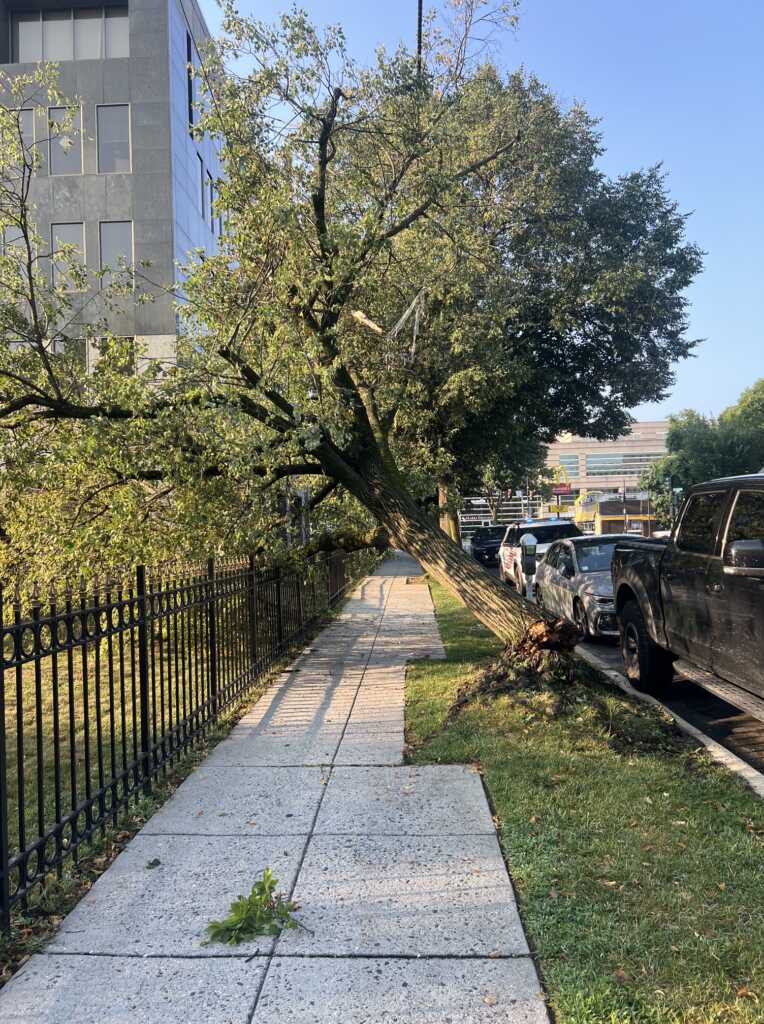
39th and Veazey Street, NW just off Wisconsin Ave
Thanks to Amy for sending: “It didn’t uproot – just cracked at the base and tipped over.” (more…)


39th and Veazey Street, NW just off Wisconsin Ave
Thanks to Amy for sending: “It didn’t uproot – just cracked at the base and tipped over.” (more…)

photos by Prince of Petworth
DEVELOPING:
Electrical pole snapped at 37th and Porter Street, NW:
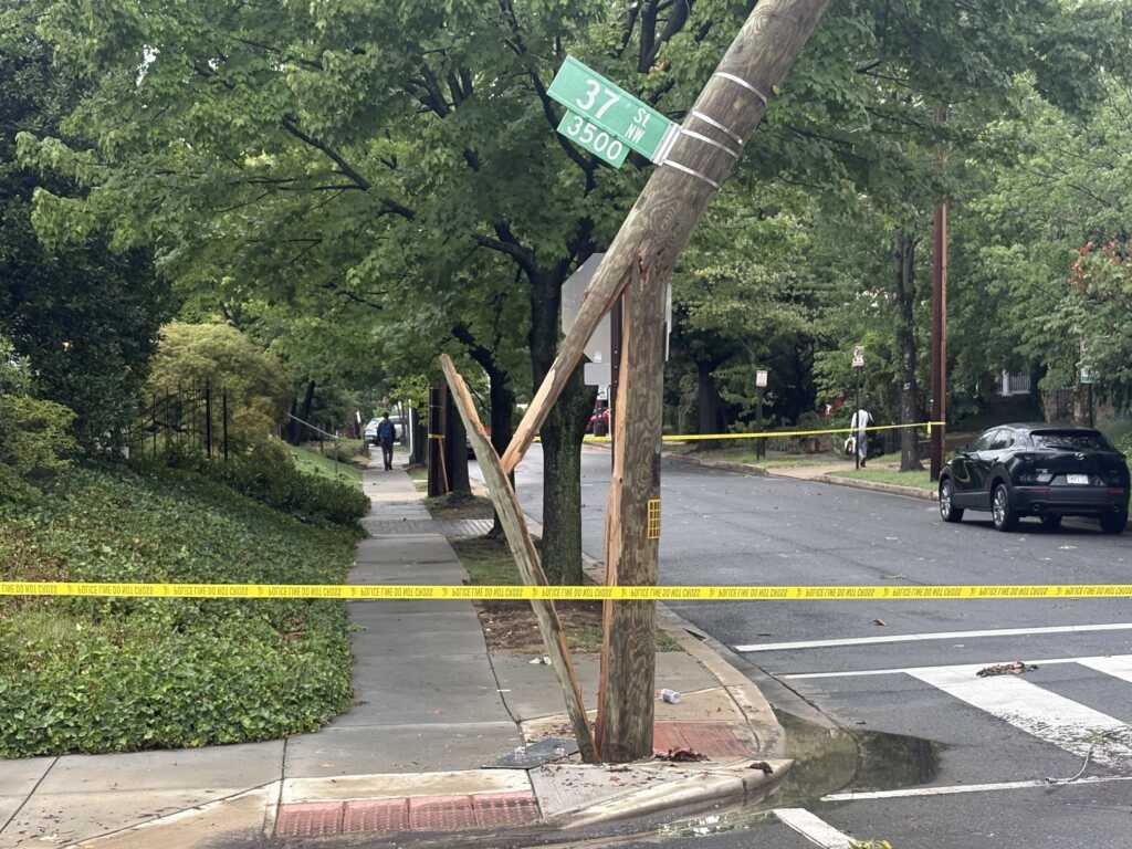
Tree down by Hearst Elementary School on 37th Street, NW: (more…)
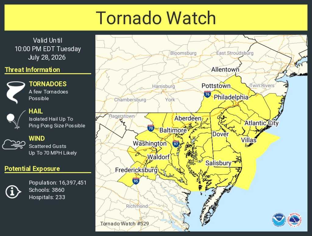
From AlertDC: “The National Weather Service (NWS) has issued a Tornado Watch for the District of Columbia until 10PM.”
From NWS: “A tornado watch has been issued for parts of Delaware, District of Columbia, Maryland, New Jersey, Pennsylvania and Virginia until 10 PM EDT”
8pm Update: “The National Weather Service (NWS) has cancelled the Tornado Watch for the District of Columbia.”
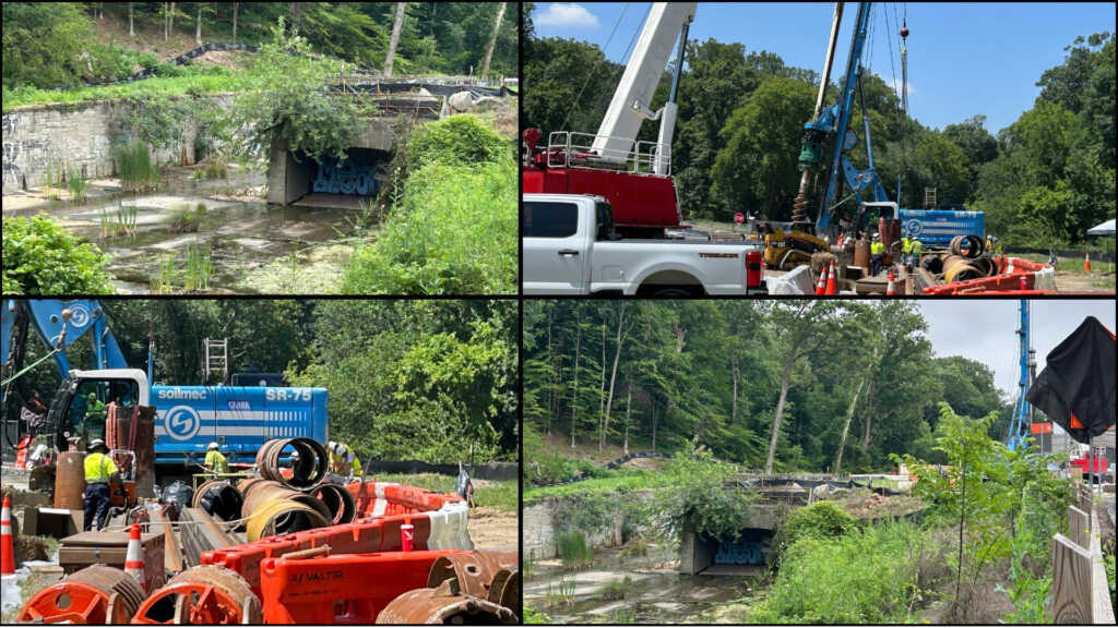
“Clockwise from top): Overflow area where combined wastewater and stormwater are released into Piney Branch; Work to construct tunnel shaft underway; Construction next to sewer overflow area where tunnel will begin; and Crews working on construction site”
Update from DC Water:
“DC Water broke ground on the Piney Branch Tunnel, the final major tunnel in our Clean Rivers Project. This work will help keep sewage and trash out of local waterways and make Rock Creek, the Potomac River, and the Chesapeake Bay cleaner for our community.
When we finish the Piney Branch Tunnel, it will hold at least 4.2 million gallons of rainwater and wastewater during heavy storms. Instead of overflowing into Piney Branch, that water will go to the Blue Plains Water Resource Recovery Facility, where it will be treated. (more…)
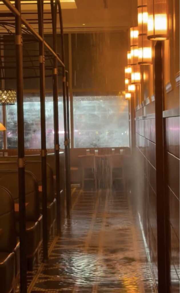
1205 Half Street, SE
Horrible sights from the Gatsby last night:
“🚧 Closure Notice
Well… this certainly wasn’t how we planned things. A little rain on our parade.
Due to unexpected repairs, Gatsby is closed while we work through next steps. (more…)
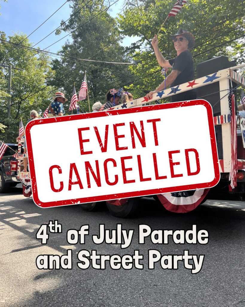
Yikes. From Main Street Takoma:
“4th of July Parade and Street Party cancelled due to extreme heat. The event will not be rescheduled.”
Stay cool.
Update:
“Due to Extreme Heat, America’s Independence Day Parade is Canceled (more…)
“Dear PoPville,
I took these pictures of Friday evening’s storm from the roofdeck of my Dupont Circle apartment building (20th & N). They are pictures of what looked to my untrained eye at the time like a tornado.
The first pic (taken at 7:19) shows the funnel cloud in the far right on the horizon (you can see the Cathedral at the very edge of the photo, which is directly northwest from my building). The second pic (taken at 7:22) caught the funnel cloud after it emerged on the right side of the Cathedral. (more…)
Thanks to Derek for sending this incredible shot above from Bloomingdale:
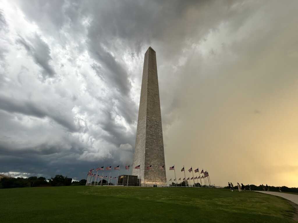
Thanks to Olivia for sending this incredible shot of the Washington Monument:
Thanks to Mark for sending the super shot below from City Center:
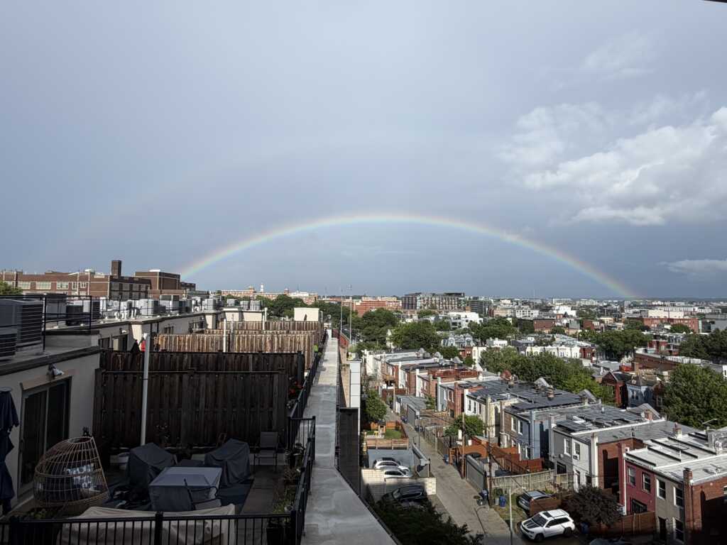
Thanks to Aubrey for sending below “A Beautiful Double Rainbow!” (more…)
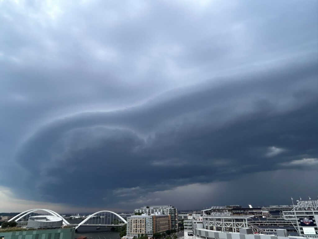
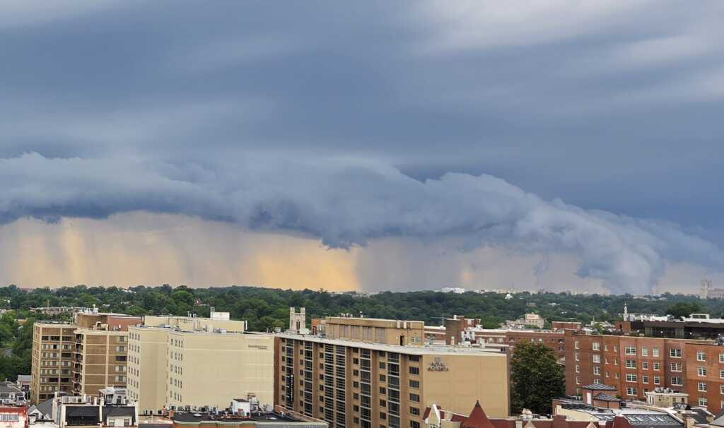
Thanks to M. for sharing the wild clouds in Navy Yard over the Anacostia River: (more…)
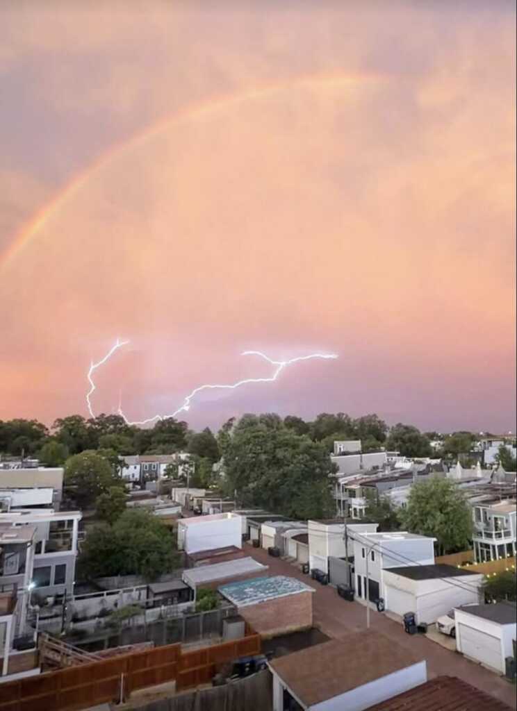
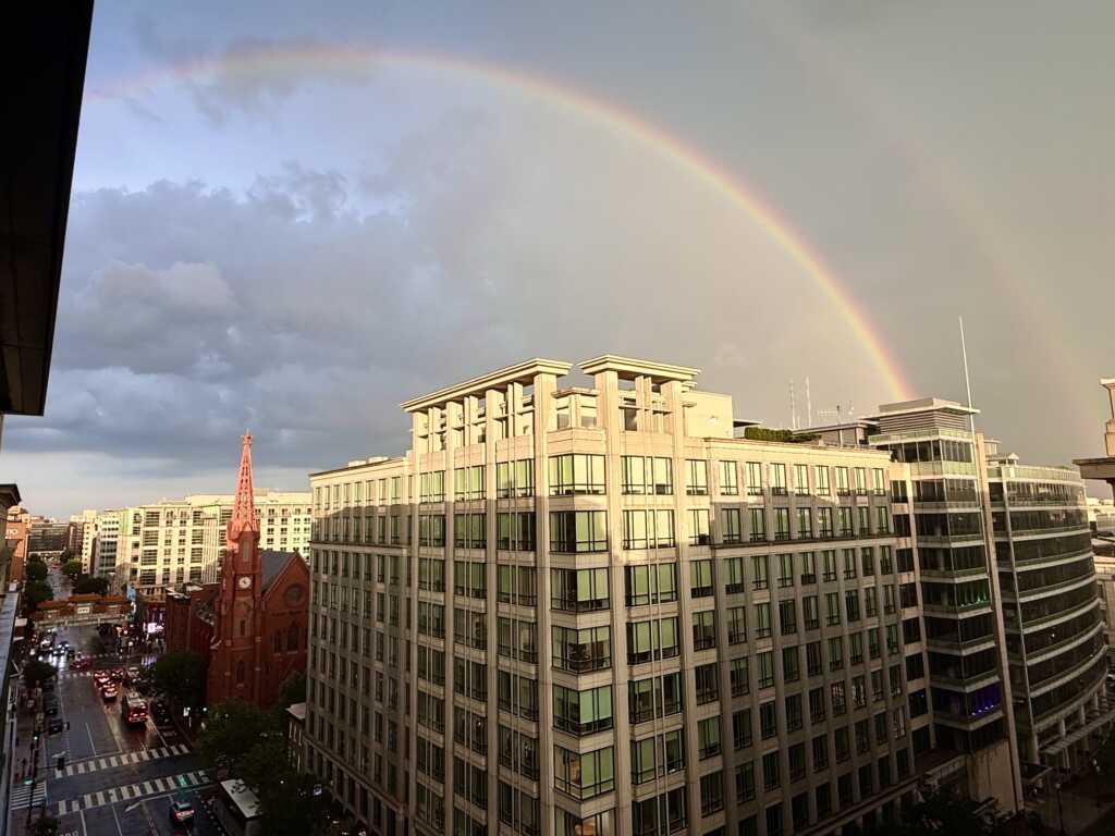
Thanks to Charles for sending the super shot above: “The years first rainbow by my count and it’s a double.”
And thanks to Nora for sending the great shot below from Columbia Heights: (more…)