

Click map to enlarge. Source: Library of Congress
Map of the Week is written by David A., a systems librarian and map geek living in Mt. Pleasant. David previously wrote about Rand, McNally & Co.’s D.C. in 1903.
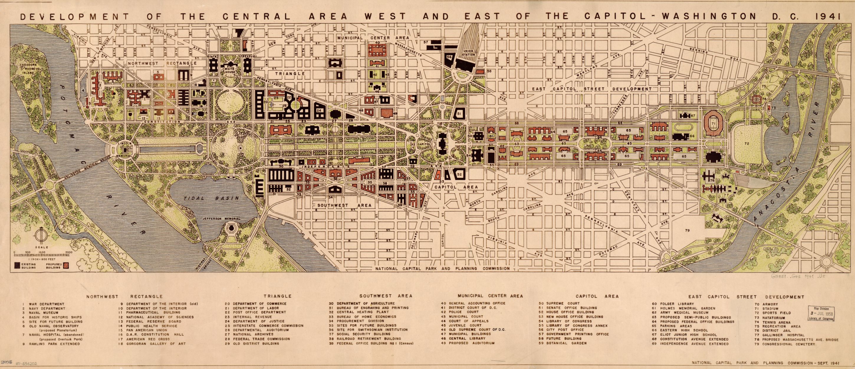
Title: Development of the central area west and east of the Capitol–Washington D.C. 1941
What if the National Mall extended all the way to the Anacostia River? This 1941 plan from the National Capital Park and Planning Commission called for the mall to bisect the city along its east/west axis from the Lincoln Memorial to present-day RFK Stadium. The plan would have involved the razing of a huge swath of residential row houses east of the Capitol in favor of federal office buildings, “semi-public buildings,” parking lots and broad avenues.
Other highlights include a basin for historic ships at the site of the Kennedy Center, a Massachusetts Avenue bridge over the Anacostia, and a sports complex next to Kingman Lake that included a tennis arena, natatorium and baseball fields.