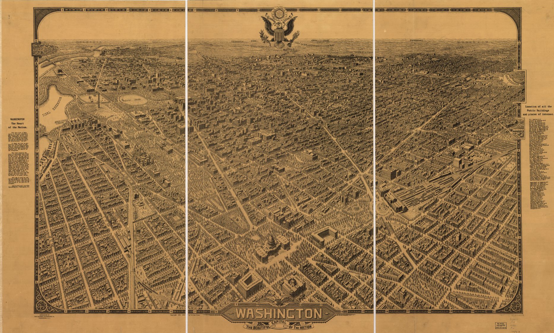
click map to enlarge. Source: Library of Congress
Map of the Week is written by David A., a systems librarian and map geek living in NoMa. David previously wrote about a Birdseye view of the National Capital from 1892.
This 1791 topographical map gives a very raw look at the DC landscape before the city had streets. You can see that topography very much defined the original city limits. Boundary Street, today’s Florida Avenue, followed the bottom of the hill that still marks the border between the U St area and Columbia Heights and Adams Morgan.
If you look closely, unmarked buildings appear throughout the city. Another interesting feature is the broad creek running just south of the White House. With the exception of Rock Creek, all of the creeks in the original city limits would be filled in or covered over. Georgetown’s street grid looks very similar to today’s grid. An act of the Maryland Legislature set in motion the building of Georgetown. Surveying was completed in 1752, and by the time of the publishing of this map it had grown into a thriving port of trade.