

Click map to enlarge. Source: Library of Congress
Map of the Week is written by David A., a systems librarian and map geek living in Mt. Pleasant. David previously wrote about City of Washington in 1792.
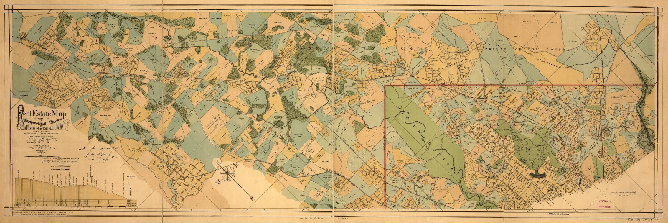
Title: Real estate map of the Metropolitan Branch of the Baltimore and Ohio Railroad Company between Washington, D.C., and Rockville, Md.
This week’s 1890 map of the Metropolitan Branch of the B&O Railroad has some great detail north of the original city limits. The Metropolitan Branch of the B&O Railroad connected DC with the B&O main line in Point of Rocks, MD. Highlights include names of property owners, locations of parks, railroads and the skeletal outlines of several Maryland towns including Takoma Park, Silver Spring, Bethesda and Rockville. The Metropolitan Branch made stops in DC at New York Avenue, University (presumably Catholic University), Terra Cotta (near Ft. Totten), Lamond and Takoma.
You can see a much larger version of the map here.