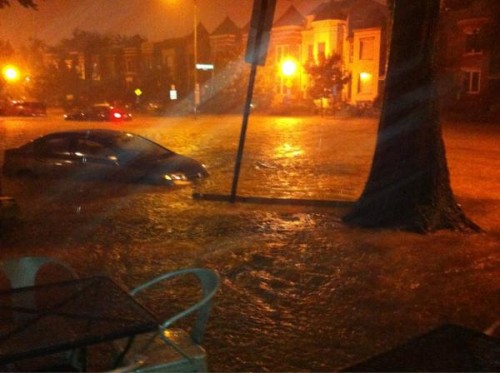
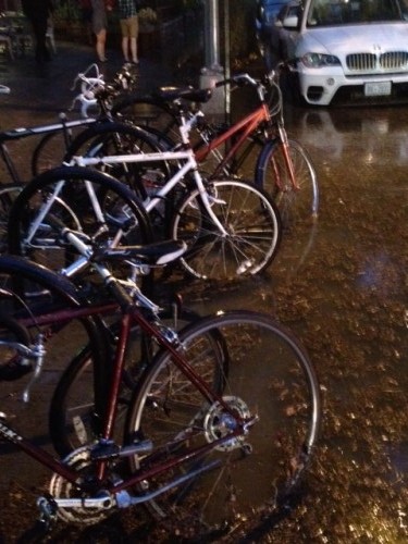
1st and Rhode Island Ave, NW Sunday night courtesy of @BoundaryStoneDC

Unfortunately more flooding in Bloomingdale Sunday night.

@IAFF36 tweeted around 7pm:

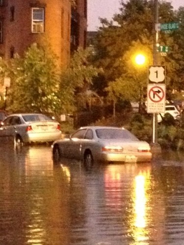
“Units responding to Rhode Island Ave NE at 1st and 2nd streets. Several cars under water with people trapped in or on vehicles.”


Photo around 7:23pm via @AnaSantosPhoto

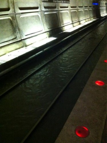
The Shaw metro stop on the green line also flooded causing a closure between Mt. Vernon Square and Georgia Ave./Petworth.

@WMATA tweeted around 9:30pm Sunday evening:

“Green/Yellow rail service btwn Mt Vernon Sq & Georgia Ave to remain suspended through system closing.”

On Aug. 22nd Mayor Gray established a flood prevention task force to address flooding in Bloomingdale and Ledroit Park.


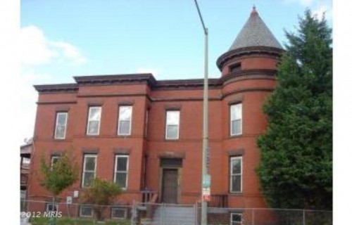
This rental is located at 101 U Street, NW:


View Larger Map

The listing says:

“Lots of new restaurants/shops. Walk to METRO. 1 BR plus Den or 2nd BR/Huge foyer can be an office/computer nook. Front and rear entrance/yd. for entertaining. Steps to Howard U., Timor Organic Grocery, Bloomingdale Farmer’s Market and Windows Cafe LB on lower level basement apartment, iron gate. Pets welcome on case by case basis. Utilities included”

This 1 bed/1 bath is going for $1,600/Mo.


From a press release:

Mayor Vincent C. Gray today announced that he was establishing a flood prevention task force that will study the causes of, and short- and medium-term solutions to, frequent street flooding and sewer backups in the Bloomingdale and LeDroit Park neighborhoods. In early July the area was inundated with flood waters three times, resulting in damage to dozens of homes and businesses.
“Residents of the Bloomingdale and LeDroit Park neighborhoods deserve to enjoy a high quality of life and should not have to bear a disproportionately negative impact because of an aging infrastructure,” Mayor Gray said. “Just as I have done in asking a task force to look at solutions to frequent power outages, I am now asking officials, utility representatives and residents to work together to address the flooding and sewer back up issues that happen all too often in these neighborhoods While D.C. Water has already been working on long-term solutions, this panel will help us bring about short- and medium-term mitigation strategies.”

The task force will be co-chaired by City Administrator Allen Y. Lew and D.C. Water General Manager George Hawkins. The panel will investigate the causes of flooding in the affected areas and work to develop actions that may be taken by D.C. Water, other District agencies and residents to reduce the likelihood or severity of flooding and its consequences.

“As a member of the D.C. Water Board, I am acutely aware of the impact of the floods on the community. The task force will monitor the interim steps taken by D.C. Water to prevent or mitigate the flooding problems in the short term,” said Lew. “DC Water has already initiated closed-circuit inspections of sewers and, along with the Department of Public Works, is distributing sandbags for any impacted residents who want them. I look forward to working with the Task Force to examine these issues and to develop possible long-term solutions.”

The task force will transmit a written report to the Mayor no later than December 31, 2012. The task force will also estimate the costs to implement the necessary remedial measures and the time periods within which those actions may be implemented.

The task force will include four members drawn from residents of the Bloomingdale and LeDroit Park communities. Mayor Gray has appointed one resident to the panel from each neighborhood, and Ward 5 Councilmember Kenyan McDuffie and Ward 1 Councilmember Jim Graham – whose wards include the affected area – will each appoint one additional representative to the panel.

Other members of the task force include: Councilmembers McDuffie and Graham; District Department of Transportation Director Terry Bellamy; District Department of the Environment Director Christophe Tulou; Department of Public Works Director William Howland; D.C. Homeland Security & Emergency Management Agency Director Chris Geldart; Department of Consumer & Regulatory Affairs Director Nicholas Majett; D.C. Department of Health Director Dr. Saul Levin; and Department of Insurance, Securities & Banking Director William White.

You can read about the recent floods in Bloomingdale here and look at a sewage and plumbing map of DC here.


1837 1st Street, NW

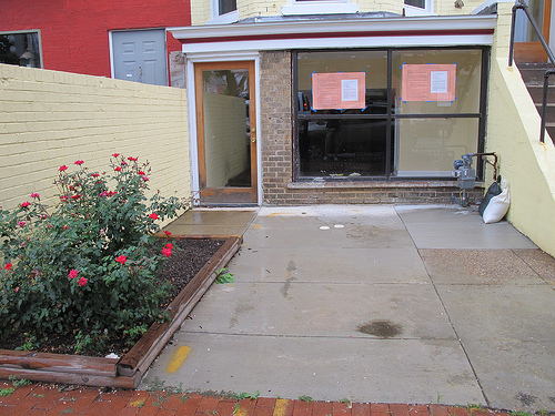
Back in May 2012 I shared some scuttlebutt that a Spanish tapas restaurant was coming to the vacant space in the yellow building next to Rustik at 1837 1st St, NW. Ed. Note: Across the street, 1822 1st St, NW will become an Italian-influenced American restaurant.

Turns out the scuttlebutt was accurate about the Spanish tapas restaurant. It will be called Costa Brava and the liquor license application posted out front says:

“Restaurant/bar serving Spanish tapas with a seating capacity for less than 50 patrons and a total load of less than 99. Requesting an Entertainment Endorsement for occasional small Spanish ensemble, acoustical trio and DJ.

In addition, requesting a Sidewalk Café with 12 seats and Summer Garden with 20 seats.”


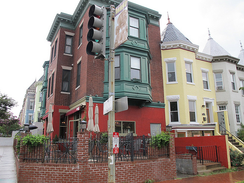
1st and T St, NW (Next to Rustik)


To view a larger map please click here

The above map was made by Sarah Hank. She contributed a crime map of DC here.

Sarah writes:

So what was in that water that flooded Bloomingdale in July?

I started this map because I was routing through some census data and came across a weird attribute:  Housing with Incomplete Plumbing.  (Definition here)  I mapped it out, and did not see a real geographic pattern in the tracts that were affected.  It seems like group housing (The United States Soldiers and Airmen’s Home being the biggest example, hospitals possibly being another) has the most to do with places with higher percentages of incomplete plumbing. I’d be interested to see what readers think about this data!

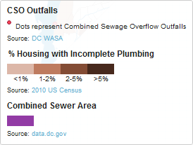
I wanted to add something else related to “sanitary” matters to the map.  With all the flash flooding that happened earlier in the summer, I thought I’d highlight DC’s combined sewage system. I added in a layer showing the extent of the combined sewage system as well as Combined Sewage Overflow outfall locations. If you don’t know about DC’s combined sewage system, it basically means that in certain places in the city, rainfall run off and untreated sewage are combined in the same sewer.  That means that when it rains and the sewer becomes too full, the dirty toilet+rain water has to be released somewhere, namely the Potomac and Anacostia Rivers, and Rock Creek.  The minimum rainfall to trigger the outfalls is sometimes as low as 0.1 in, and at most 1.7 in. There are other outfalls in town, but I’m not totally sure how those work as I never see water flowing out onto the streets, say, at Q & 22nd NW.  Check out this informative guide from DC Water.  To be clear, DC Water does have a plan to convert the combined system into a separate system.  But for now, heed DC Water’s warning: “Please note that the District of Columbia Department of Health has imposed a ban on swimming in all rivers and creeks in the District of Columbia and any contact with rivers and creeks immediately downstream of any sewer pipe discharge should be avoided.”

Regarding concerns about flooding in Bloomingdale (which from the map, you can see is directly in the middle of the combined sewer area), DC Water has committed an entire page on their site to the issue.  Bloomingdale neighborhood residents who attended a special meeting by DC Water on August 4th would have seen this powerpoint.  I’m not going to claim to understand the situation fully, but it seems to me that the water that flooded the streets as well as numerous basements as a result of backed up sewers was likely the combined rainfall and sanitary waste water that I spoke about above. Raw sewage soup.

Do people know about this?  If there was really human waste in the flood water, why weren’t more people talking about it?


Photo by PoPville resident SG

Thanks to all who sent links to the new page by DC Water:

“The flooding events of July 2012 are evidence of a change in the Bloomingdale neighborhood since DC Water last extensively surveyed the area in 2006. The permanent, long-term solution is the Clean Rivers Project, scheduled for 2025. In the meantime, our Bloomingdale Action Agenda is a list of specific steps DC Water, residents and businesses, and other parts of the government are taking and can take to reduce the effects of runoff and flooding.”

DC Water also wrote in an email:

“We have already begun implementing what I call our Bloomingdale Action Agenda,” commented DC Water General Manager George S. Hawkins. “This is a list of specific steps DC Water, residents and businesses, and other parts of the government are taking and can take to reduce the effects of runoff and flooding.”

In addition, DC Water and Councilmember Kenyan McDuffie are in communication about coordinating a multi-entity examination of this problem. District and federal agencies with jurisdiction over streets and alleys, stormwater management, plumbing codes, insurance and flood plains, and residents, all have a part in this discussion.

DC Water will also attend a special meeting of the Bloomingdale Civic Association on Saturday, August 4 at St. George’s Episcopal Church, 160 U Street, NW in the basement.

Another reader sends a note from Teri Janine Quinn, President, Bloomingdale Civic Association:

We met with DC Water during the Bloomingdale Civic Association held this past Monday. Many residents were underwhelmed by DC Water’s presentation. We agreed to host a second public meeting with DC Water on Saturday, August 4th (time and location to be determined). It is troubling to know that many residents just experienced flooding for the third time in less than two weeks. It has become painfully obvious that we cannot wait indefinitely for solution.

As an initial matter, we need to get a better understanding of how many residents have been impacted and the scope of the damage. These questions were asked of DC Water during our meeting but the representatives were unable to provide clear and concise responses and have not since followed up with additional data. Even if DC Water provides information regarding the impact and scope of the damage, unless we assess the problem on our own we will have no way of evaluating the accuracy of their data. As such, Please find below a link to a brief survey (10 questions) for residents who have experienced flooding. You do not need to complete the survey if you have not experienced flooding. In addition, we only need one survey completed per address. The information we collect will be useful in discussions with DC Water and elected officials. As such, if you have experienced flooding recently or in past years, please complete the survey as soon as possible but not later than Wednesday, July 25th. Here’s the link to the survey:

Bloomingdale/LeDroit Park Flooding Survey


1635 North Capitol Street, NW

Dear PoPville,

Does anyone know the official plans for 1635 North Capitol Street? Progress has been slow on this building, but recently it has been picking up. It looks pretty good so far. I had a brief conversion with a contractor right after the storefront was installed. He said the place was going to be a wine bar.

Back in Aug. 2011 we looked at a Craigslist ad mentioning a wine bar coming to the retail space at 1635 North Capitol St, NW (former Borf building.) Has anyone else heard that a wine bar was still planning on coming to that space?


@ColonelKSpeaks sends the shot of the flooding from Rhode Island Ave, NW between 1st and 2nd Street.

Update More photos from folks at Boundary Stone (1st and Rhode Island Ave, NW). I’m happy to report that Boundary Stone remains dry and open!

Check out the Fire Department. I’m told they have boats and scuba gear:

Continues after the jump. (more…)


View More Stories