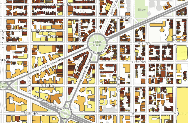
Almost exactly a year ago we got a preview of a phenomenal map about the history of DC buildings. Of course the map was immediately taken down for some reason. Well it is back and in full effect! Thanks to Betsy for sending from the DC Office of Planning:
“The D.C. Historic Preservation Office announces the launch of HistoryQuest DC, a GIS-based web map that provides historical data on approximately 127,000 extant buildings in Washington, D.C. The historic data is easily retrievable and can be queried and mapped, providing a new tool for illustrating the city’s building history and patterns of urban development.”
As I said the first time we saw it – Warning a serious time suck in the best of ways for those of a particular proclivity. Perfect for this rainy day!!
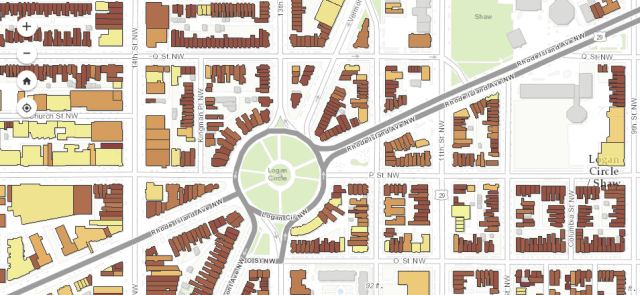
Thanks to commenter crin for sharing this incredibly (Warning a serious time suck in the best of ways for those of a particular proclivity) awesome mapping tool:
“Click a building, see the original permit date and number.”

Photo by PoPville flickr user Eric P.
DataLensDC was started in the summer of 2015 by Kate Rabinowitz, lover of all things data and District. She lives in a cozy Capitol Hill carriage house where she enjoys data mining, board games and wandering the city. Kate created to DataLensDC to present data-driven views of the character, trends and hacks of the ever-changing District.
My husband’s first words to me were basically “Where can I find a good local farmer’s market?” to which I responded MARRY ME. That’s how much I like farmer’s markets. I’ve been fortunate that wherever I’ve lived in the District a good farmer’s market has never been more than a short Saturday morning jaunt in warmer months. I was curious if I simply gravitated to places near markets or this was more of a universal DC experience, and how DC compared to other American cities. Read More
click to enlarge
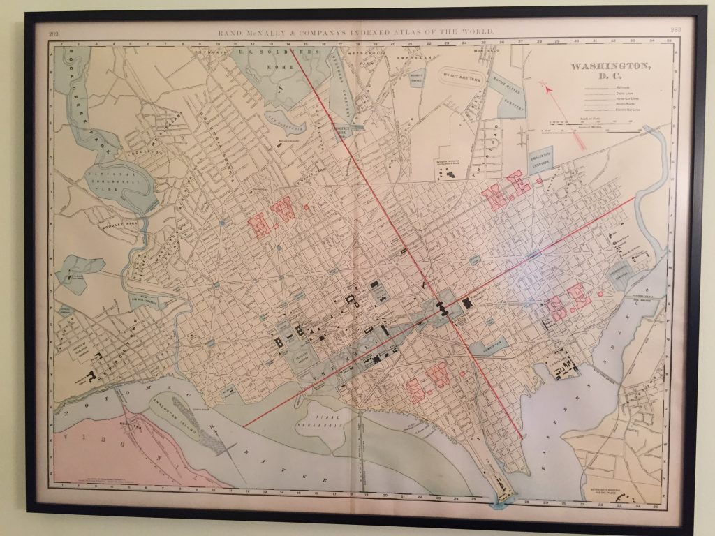
Thanks Mom and Dad! Here are a list of neighborhoods captured from this section of a Rand McNally 1898 map:
1. Petworth
2. Columbia Heights
3. Mount Pleasant
4. Ingelside
5. Meridian Hill
6. Washington Heights
7. Belair Heights
8. Woodley Park
9. Burleith
10. Georgetown
11. LeDroit Park
12. Dobbins Add.
13. Bloomingdale
14. Metropolis View
15. Brookland
16. Edgewood
17. Montello
18. Eckington
19. Ivy City
20. Trinidad
21. Rosedale
22. Isherwood
23. Uniontown
*24. Rosslynn
Ed. Note: Metropolis View is just east of the soldiers home and west of Brookland and must be brought back into usage immediately. I also think it’s time to bring back the Ivy City Race Track – are you listening Douglas Development – bring back the Ivy City Race Track please!!
A reader writes:
“One City?
Someone seems to have forgotten about the Anacostia river……”
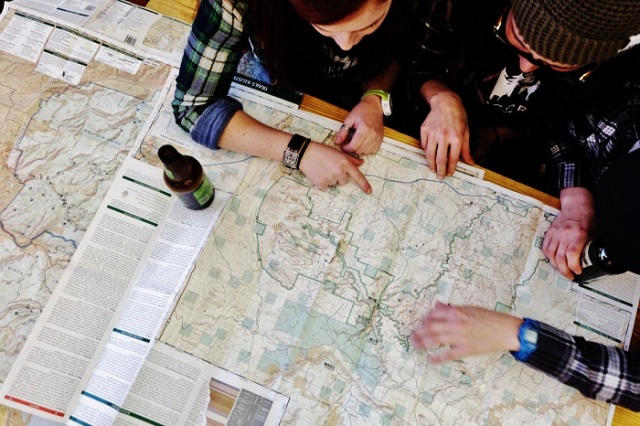
Photo courtesy Mappy Hour DC
From an email:
“We had so much fun at Meridian Pint last time that we’re back again!
This month we’ll hear from urban fly fishing consultant Rob Snowhite. He’ll cover how to start, where to go and other tricks of the trade for fishing in the D.C. area. Join this new outdoor enthusiast community with maps, adventure planning and beer. Don’t forget to bring a map to share!
When
March 30th, 2015 at 7:00PM
Where
Meridian Pint, 3400 11th St NW
Register
Registration is free.”
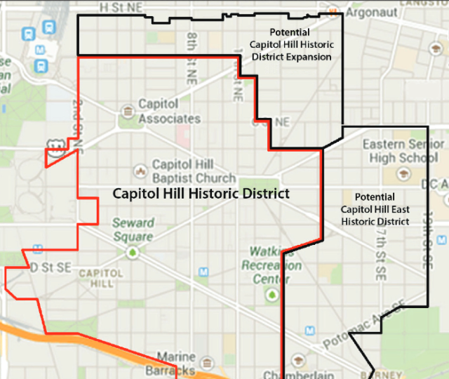
Map via Capitol Hill Restoration Society
Thanks to Justin for sending:
“Wednesday, November 5
Expansion of the Capitol Hill Historic District: The Capitol Hill Restoration Society will sponsor a series of public meetings to present a case for expanding the Capitol Hill Historic District. The first of these – concerning ANC6A area – will be held from 6:45 – 8:30 pm, Maury Elementary School multipurpose room, 13th and Constitution Avenue, NE. For more information, see here.”
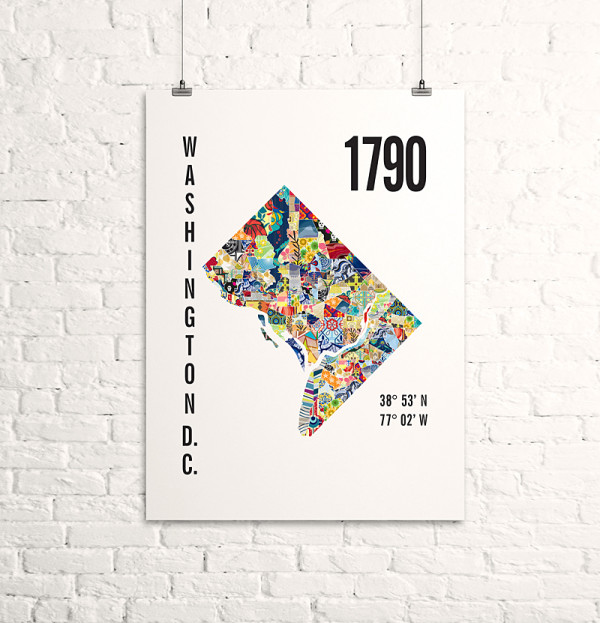
I thought these look pretty great. From an email:
“Yesterday I released my Washington DC City Map. The Washington DC City Map includes the year of settlement, the city’s longitude / latitude and a map with each neighborhood filled with one of my patterns. It comes in 3 sizes and starts at $10.”
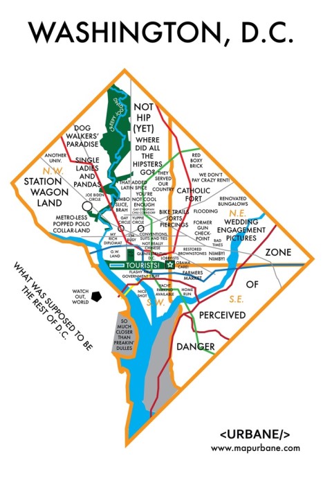
Map via Urbane click image to enlarge
A reader sends the above map from Urbane:
“Washington, DC. Your complex fabric of diagonal streets, circles and lobbyists make for a city that’s difficult to easily approach. In the wake of the shutdown, many think that DC is just about politics. We think it was about time to internalize the heated discussion and reveal that DC isn’t just about those folks on C-SPAN Capitol Hill.
It’s your fixie bike and pandas, too.”
Well this is cool. Check out his kickstarter campaign here.